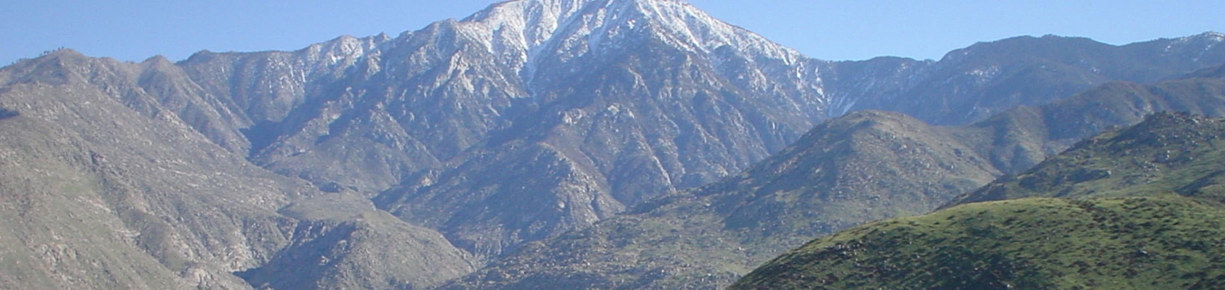

The James San Jacinto Mountains Reserve is located on an alluvial bench situated at the lower end of Hall Canyon, a steep, western flank of Black Mountain. The reserve hosts a wide variety of plant communities: Sierra mixed conifer riparian forest, oak woodlands, montane chaparral, alder-willow-cedar riparian forest, and dry meadows. Habitats include mixed conifer and hardwood forest, montane chaparral, montane riparian forest, and a rapidly flowing mountain stream with manmade Lake Fulmor reservoir immediately downstream.
The entire watershed is protected for research and study by the U.S. Forest Service. There are records of 259 species of vascular plants, 35 bryophytes, 6 amphibians, 18 reptiles, 125 birds (60 percent nesting), 35 mammals, and ~1,000 invertebrates.
Operating as a satellite to the James Reserve, the Oasis de los Osos Reserve is located at the west end of the Coachella Valley, north of Palm Springs, and encompasses 65 hectares (160 acres) situated on a steep elevational gradient near the base of the north-facing escarpment of Mount San Jacinto. A perennial stream, Lambs Creek, runs through the site, supporting on of the very few riparian woodlands in the Colorado Desert. In 1971, The Nature Conservancy purchased the land with funds donated by Mr. Robert Bear, after whom the site was named (“oso” means bear in Spanish). In 1987, The Nature Conservancy deeded the land to the University of California to be used as part of their Natural Reserve System.
Field Courses
Extensive teaching use of the site by university-level courses in biology, botany, animal tracking, earth philosophy, zoology, ecology, others.
Public Outreach
Local community welcomed for tours and courses on site; Riverside County K-12 students visit for daylong and overnight field trips; Idyllwild community can use GIS for fire prevention and planning.
Selected Research
- Forest-stewardship database and multimedia geographic information system (GIS): Comprises multiple-scale remote-sensing inventories of land use, plant communities, species observations, digitized photo-monitoring images of the San Jacinto Range.
- Long-term monitoring: Extensive data sets collected from seasonal bird banding and nest boxes, mark/recapture of herpetofauna; surveys of vernal pools, rare plants, California spotted owls, declining mountain yellow-legged frogs; dendrochronology-climate reconstruction studies; continuous recording of weather variables.
Special Research of National Significance
- Science and Technology Center (STC): Center for Embedded Networked Sensing. These wireless embedded networked sensing systems developed by CENS provide essential infrastructure for NSF-funded ecological observatories.
- North American Carbon Program Determining California’s Carbon Budget
- Physiological, Demographic, Competitive and Biogeochemical Controls on the Response of California’s Ecosystems to Environmental Change
Contact Information
Casey Woodall - Reserve Director
UC James Reserve
P.O. Box 1775 (20950 Highway 243)
Lake Fulmor Idyllwild, CA 92549
caseyw@ucr.edu
James San Jacinto Reserve website
Location
Riverside County, 13 km (9 mi.) north of Idyllwild on State Highway 243. 80 km (50 mi.) east of UC Riverside.
Facilities
Trailfinders Lodge dormitory for 28 (kitchen, dining/ meeting room, 2 baths); 2 small cabins housing 10 each (kitchen, dining room, bath), large cabin housing 20 (kitchen, dining room, bath), tent campground for 10; classroom, campfire circle; outdoor BBQs; data center, electronics workshop, library, herbarium, faunal collections; weather station; internet-accessible sensor network arrays for climate, soils, phenology, canopy, and avian observations; trail system.
Reserve bibliography
The reserve bibliography includes citations of journal articles, books, theses, art, and other works published about or based on activities conducted at the reserve.
James San Jacinto Bibliography
Databases
ArcView and Arc/Info GIS coverages for most of San Jacinto and Santa Rosa Ranges; relational database of species lists, research projects, monitoring records, permanent vegetation plot data; aerial photography and photomonitoring records since the 1940s.
Personnel
On-site reserve director.
Size
12 hectares (30 acres); plus additional 65 hectares (160 acres) at satellite reserve Oasis de Los Osos.
Elevation
1,623-1,692 m (5,325-5,550 ft.) Black Mountain: 2,369 m (7,772 ft.)
Average Precipitation
665 mm (26.21 in.)
January: 11 cm (4.41 in.)
August: 2.4 cm (0.96 in.)
Average Temperatures
January: -2 ºC (28 ºF) to 12.2 ºC (54 ºF)
August: 10.5 ºC (51 ºF) to 28.8 ºC (84 ºF)