
OAKLAND, California—The University of California Natural Reserve System has received a $2.179 million grant from the Gordon and Betty Moore Foundation to monitor the pulse of water through state ecosystems. The California Heartbeat Initiative-Freshwater (CHI-Freshwater) will link plant responses to environmental conditions such as heat waves, rainstorms, and drought on a landscape scale. The results will be used to produce forecasts of environmental health that can help Californians weather the vagaries of climate change.
“We live in a state where water is at the core of a lot of things. Given the importance of agriculture and natural habitats to California and its growing population, climate change makes understanding water on the land even more important,” says UC Berkeley biology professor David Ackerly. “California sits at a tipping point, with desert to the south and temperate rainforest to the north. It’s a place where we need to be particularly attentive to the direction of change.”
The initiative will study water in habitats with different hydrologic balances, from northern conifer forests to southern deserts, and from the coasts to the mountains. Most study sites will be part of the more than 756,000 acres of protected lands in the UC Natural Reserve System (NRS). A network of more than 39 wildland sites that includes most major California ecosystems, reserves are managed to support research, teaching, and public service.

Project scientists will examine how water on the surface and below ground varies, providing information on the types of vegetation different hydrological conditions can support. This will be the first project in the NRS to focus on freshwater and examine a range of habitat types simultaneously with an identical array of climate instruments across the breadth of the state.
“CHI-Freshwater will not only advance our ability to cope with climate change, but establish the reserve system as a resource that directly benefits California,” says Peggy Fiedler, executive director of the UC Natural Reserve System. The project is UC system-wide, involving at least ten NRS reserves plus scientists from all of the UC campuses.


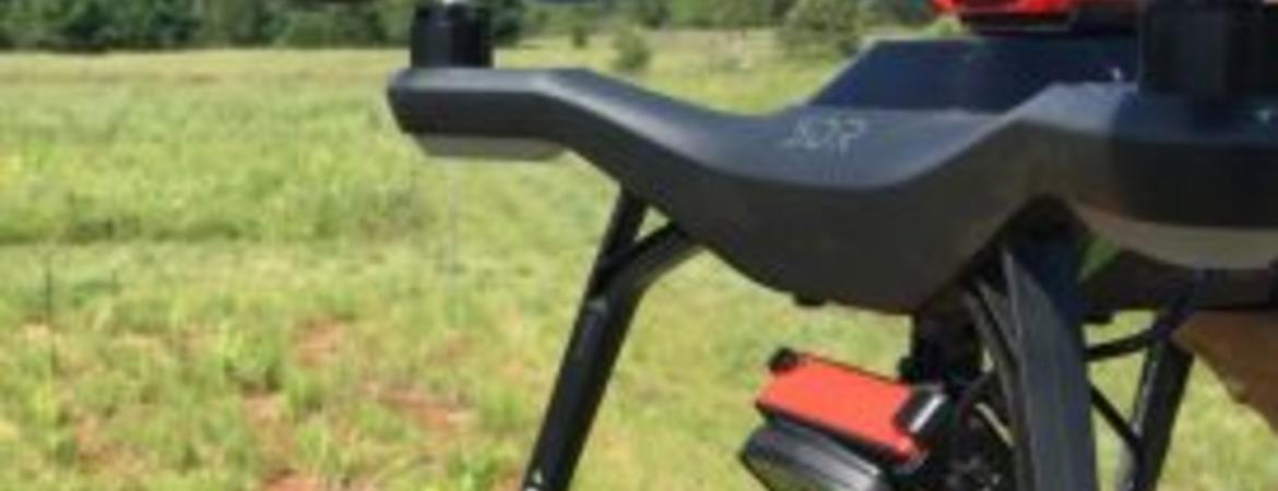
CHI-Freshwater will apply next-generation sensing technology to ecological questions. A standard toolkit consisting of drones, microclimate sensors, multispectral cameras, and other instruments will be deployed at a variety of protected lands across the state. By collecting this suite of information across different geographic locations, habitat types, and seasons, the project will track the hydrological status of wildlands in unprecedented detail.
“We have the drones. We know the cameras and the wireless sensor systems work. We’re just applying it in new ways to help us rethink how we manage land and water together,” says UC Berkeley professor Todd Dawson, a plant physiologist and lead investigator on the project.

Drones will enable the researchers to quickly scan vast swaths of land. Once programmed to follow a flight path, drones can follow the same route again and again with a high degree of accuracy. Add to this the ability to cover rugged terrain with ease, and using drones to survey vegetation is far more efficient than collecting the data by hand.
“Using drones to do these surveys has made the whole process so much more doable, and the accuracy of the repeated flight paths gives a glimpse into how the landscape really changes through time,” says Becca Fenwick, NRS Director of IT and CHI-Freshwater coordinator.
Each drone will be outfitted with a pocket-sized multispectral camera. The camera’s sensors detect the red, green, blue, and near-infrared light wavelengths reflected off vegetation. Ratios of these wavelengths can indicate whether it is thirsty, how much water it’s using in photosynthesis, and more.

Using multispectral cameras to obtain the relative water content of a plant is far easier than the traditional method. The “pressure bomb” technique requires dragging a gas cylinder and cumbersome equipment into the field to examine one plant leaf at a time. CHI-Freshwater will establish reference values for how multispectral image data in different plant species compares with pressure bomb measurements.
Drone camera data can also be stitched together to construct 3D orthomosaic images of trees and other vegetation. These digital models provide volumetric information that can improve the water use estimates for redwood trees and other large, complex plants.
“Because we’re such visual animals, when you see these images, it just clicks. People’s minds race with a million things they want to do with it. That means the tool will be adopted by a lot of people and we can start learning more new things about the environment we haven’t dreamt before,” Dawson says.
Climate information will be gathered by a network of 20 miniaturized sensor nodes laid out across each study site. Each node consists of a thermos-sized, solar-powered weather station that takes continuous measurements of temperature, humidity, barometric pressure, soil moisture, and solar radiation. Nodes provide far greater detail about the environment than the single weather station traditionally used to represent conditions for miles around. Individual nodes communicate wirelessly with one another so data can be automatically transmitted back to a central recording site.

One such microsensor network has been operating for a decade at the NRS’s Blue Oak Ranch Reserve east of San Jose. Its presence makes the reserve an ideal place to test how to integrate microsensor locations and drone flight paths in CHI-Freshwater protocols. Other planned study sites include Angelo Coast Range Reserve, Boyd Deep Canyon Desert Research Center, Landels-Hill Big Creek Reserve, Point Reyes Field Station, Quail Ridge Reserve, Santa Cruz Island Reserve, Sierra Nevada Aquatic Research Laboratory, Steele/Burnand Anza-Borrego Desert Research Center, and Sequoia and Kings Canyon National Parks.
By taking detailed measurements of how vegetation uses water across the state over a number of years, the researchers plan to link specific ecological effects to climate shifts.
“For example, will south-facing slopes, which already tend to be warmer, heat up as fast or faster? And are plants in some microclimates more sensitive than others? We need information from our sensors to determine this,” Ackerly says.

CHI-Freshwater will help shrink regional climate models to a scale relevant to individual habitats and neighborhoods. Its data will anchor the myriad possibilities used in the models to real life measurements.
“This is a great opportunity to integrate small, hyper-local scale data and information to regional scale models. We can study what water is doing in one particular site and link it to ground climate data, camera images, drone data, and ultimately to regional satellite data. We’ll be seeing the environment literally from the ground up,” says Fenwick.
The models, in turn, will help generate forecasts useful to land stewards, farmers, policy makers, and the public. For example, biologists conducting habitat restorations might use the information to select plant species able to handle tomorrow’s hotter, drier conditions. Or an almond grower could decide to reduce the number of trees in their orchards to match anticipated water resource reductions.
“CHI-Freshwater builds on a host of technologies we’ve invested in the NRS over the past decade, making the NRS an unparalleled platform for this statewide study,” Fiedler says.
This platform includes instrumentation supporting the Institute for the Study of Ecological and Evolutionary Climate Impacts, funded by a UC President’s Research Catalyst Award; the NRS Climate Station Network, made possible by National Science Foundation and the American Recovery and Reinvestment Act (ARRA) grants; the Hydrowatch program funded by the Keck Foundation; and the Eel River Critical Zone Observatory, part of NSF’s Critical Zone Observatories program.
The Gordon and Betty Moore Foundation fosters path-breaking scientific discovery, environmental conservation, patient care improvements and preservation of the special character of the Bay Area. Visit Moore.org or follow @MooreFound.
Let us help you with your search